How can we guarantee the integrity of existing buildings while continuing to develop urban spaces? Professor Debra Laefer's ERC-funded project tackles fundamental problems at the interface between new engineering undertakings and building conservation. The research team will draw on a largely unmined data source to create a system to predict the degree of damage likely to be sustained by buildings as a result of tunnelling.

Protecting our heritage
Prof. Laefer and her team aim to reduce both the rates of building damage and their affiliated costs by improving current systems of damage prediction. Tunnelling is increasingly common with the spread of urban development and the tendency of populations to cluster in densely inhabited urban areas. It is estimated that by the end of 2015 there will be 59 cities with populations exceeding million. In order to protect existing buildings (especially heritage ones) while servicing the transport and utility needs of such urban centres, it is important to better understand the impact of subsurface engineering activities.
In Europe, one of the greatest economic generators is cultural tourism, yet the continent is also a major centre for building and tunnelling. While the architectural fabric of our cities has to be protected, we need to provide transport and utility services for its inhabitants and visitors - and this means exploiting the underground. Prof. Laefer explains: “effective tunnelling-induced damage prediction requires extensive knowledge of the geometry and material properties of the above-ground structures, yet such information is rarely available, especially at a city-scale level. These deficits pose major challenges to using our computational models. Additionally, when assessing risk there needs to be a balance between maintaining standards and preventing subsurface construction. A deeper knowledge of potential damage during tunnelling and harnessing current technological developments are essential factors to reaching this balance.”
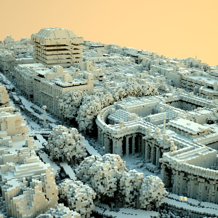
To help overcome existing knowledge gaps, Prof. Laefer’s project is developing methods to automatically extract building geometries from aerial laser scanning (a form of remote sensing) and convert that data into models compatible with computational modelling for engineers. An optical sensing technology known as Light Detection and Ranging (LiDAR) will be used to measure the dimensions of a building by illuminating it with a laser and analysing the reflected light. The resulting output will then be gathered and interpreted with a series of post-processing algorithms and finally with probabilistic methods to better predict the impact of subsurface activity on the building, especially for unreinforced masonry buildings. Prof. Laefer’s research takes a holistic approach to the subject by incorporating techniques varying from city-scale aerial data collection and modelling to condition assessment of the individual buildings.
Mapping future cities
The predictive mechanisms for assessing the scale of building damage will be accompanied by significant developments in the use of city-scale aerial scanning. Rather than relying on existing means of aerial laser scanning, which represent the entire city as a single entity, researchers will remodel the data acquisition process for more comprehensive city-scale representations. This exploratory work will establish a series of techniques that will enable scanning of any city with unreinforced masonry buildings in a way that maximizes the vertical façade data capture and minimizes occlusions.
The ultimate ambition is that this work can then be cross-applied for a range of other urban concerns spanning from micro-climate issues to disaster response. With applications in fields as diverse as micro-climate modelling and disaster management, the future of this research area is sure to be dynamic, as well as high impact. Indeed, the technology's potential use in disaster management has already led Prof. Laefer’s team to begin using unmanned aerial vehicles to gather relevant remote sensing data.
Prof. Laefer’s ERC grant has enabled her to recruit an excellent team. She explains: “The longer-term funding has provided the opportunity to bring together a group of research aspirations and to put them into practice in a high impact environment. Securing five years’ funding means that the team has greater latitude for high-risk research and there is the room to be more strategic. We have the freedom to begin developing the future of this growing research area and ensure a pipeline of expertise - a particular challenge when short-term funding brings with it the risk of gaps in support, which leads to equipment underuse and knowledge losses in the research group.”
“The ERC grant has also attracted a higher calibre of unsolicited collaborators who are helping us to push the applications of the research further. As a result, my group has set up a 3D printing centre - a development which has leveraged wider funds in Ireland, because it is a unique facility here.”


