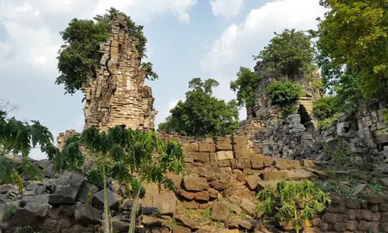
Frontiers of archeology: Discovery in Cambodia
Dr Damian Evans from the École française d’Extrême-Orient and his team used a laser radar mounted on a helicopter to scan the jungle in Cambodia in 2015. What resulted was one of the most important archeological discoveries in recent years.

Dr Evans received an ERC Starting Grant for his Cambodian Archaeological Lidar Initiative, or CALI, in 2014, and thanks to this funding he moved his research from Australia to France. His idea was to use airborne laser scanning to uncover, map and compare archaeological landscapes around all the major temple complexes of Cambodia.
In 2015 the team carried out the most extensive airborne study ever undertaken by archaeologists. They scanned an area comparable in size to Greater London (1,901km2) and discovered an extraordinary archive of human activity inscribed on the ground beneath the vegetation, spanning from recent times, through the great empire centered on Angkor from the 9th to 15th centuries AD, and all the way back to prehistory.
When he began the project he suspected that there would be some major findings, but did not know exactly where those would be. But there was a real risk of finding nothing. “To me, one of the most appealing things about the ERC, is that it explicitly recognizes the potential for negative results and allows researchers the latitude and the funding to pursue ‘blue-sky’ research,” said Dr Evans. Happily, they were able to uncover quite striking results which have completely changed our picture of what early cities looked like in various parts of Cambodia.
His ERC project also provided hints about the present urbanism and sustainability of big cities. As Angkor is comparable in some ways to contemporary megacities, it can be considered a kind of laboratory for understanding how, in the past, such cities have succeeded – and ultimately failed.
The research showed the potential of new technologies in certain areas of archaeology, for example in the study of archaeological landscapes. Geoinformatics and ‘big data’ have created a whole range of opportunities for interdisciplinary work by combining different fields to find and research patterns within data.
What are the plans for the future? The lidar data collection phase of our project is finished, and the team is verifying findings on the ground before more analysis and publications. Beyond that Dr Evans is keeping a keen eye on developments in technologies like UAVs, lightweight lidar instruments, and satellite-based lidar technologies. “There is enormous untapped potential for these technologies in tropical forest environments, not just for archaeology but also for other disciplines, all across Southeast Asia and beyond” he says.
Follow Damian Evans on twitter: @ArchaeoAngkor
This article was first published in ERC Annual Report 2016.


