Into the Deep
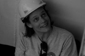
A team of 28 scientists and engineers led by ERC grantee Dr Veerle Huvenne has just returned from a successful 5-week expedition on board the RRS James Cook. They used tailored marine equipment to provide some of the first detailed acoustic maps of the fauna inhabiting the vertical cliffs of the Whittard Submarine Canyon. In this interview, Dr Huvenne shares her impressions on an extraordinary scientific journey.

Biodiversity is an important indicator of the health and functioning of underwater ecosystems. However, deep-sea environments remain largely unknown, due to the irregularity of the landscapes and the challenging conditions in the depths of the Ocean. The aim of the ERC CODEMAP project, Dr Huvenne's research funded by the ERC, is to map complex deep-sea habitats, quantify habitat heterogeneity and test its potential as a proxy for biodiversity. Aiming to establish the link between geological structure and biological species, Dr Huvenne has been pioneer in combining a variety of fields and techniques, from marine geology and ecology, to remote sensing and underwater vehicle technology.
Hotspots for biodiversity
Submarine canyons have been identified as potential hotspots for biodiversity. They are the main pathways between the shallow, coastal waters and the deep sea. They present complex and challenging 3D structures where high current speeds can be found which transport sediments, and where nutrients accumulate, thus attracting a wide variety of submarine species of fishes, crustaceans and cold-water coral. But canyons can also act as high-speed channels, bringing human waste into the depths of the Ocean. Knowing the impact of human actions in deep-water, is a pressing condition for the protection of these fragile ecosystems.
"There is an urgent need for more effective marine spatial planning as human activities, including fishing, are rapidly moving into deeper waters. But how to decide which areas to protect? Where are the richest ecosystems? We cannot video every square metre, let alone the entire Ocean!", says Veerle Huvenne, who is currently working as a research scientist at the National Oceanography Centre in Southampton, in the UK.
During their first expedition at sea, in 2011, the CODEMAP team could map and photograph a range of habitats under threat of deep-sea fishing in the Rockall Trough and Rockall Bank area, west of Ireland and the United Kingdom. As a result, preventive measures to protect this area were adopted.
Seeing is believing
From all the existing submarine valleys, Dr Huvenne's next focus is on the Whittard Canyon, in the Bay of Biscay. During five weeks (in August and September) and with team of 30 scientists and engineers, she will explore and collect data from one of the largest submarine canyon systems along the Celtic Margin, comprising four main branches of more than 110km long. Water depths can reach from 200 to over 4000m, with near-vertical walls along which the traditional equipment cannot navigate.
To explore the canyon, the team will use the latest technology in deep-sea research. Equipped with a remote operated vehicle and an autonomous underwater vehicle, they will collect samples; take videos and pictures of the sea bed, and carry out acoustic mapping of the canyon walls. With a third vehicle, they will measure the physical properties of the water column, including salinity, temperature and turbidity.
The aim of the summer expedition is to test the accuracy of the statistical models elaborated in the previous phases of CODEMAP that predict the biodiversity levels for each underwater location and community of species. To apply these models, Dr Huvenne's team previously combined bathymetry data of the canyon, collected with echosounders, with video information obtained at specific locations.
The Wittard Canyon scientific journey is the fruit of a cooperation between the European Research Council (ERC); the Natural Environment Research Council (NERC), UK; the University of Southampton, UK; the University of East Anglia, UK; the National University of Ireland; L'Institut Français de recherche pour l'exploitation de la mer (IFREMER), France; the University of Aveiro, Portugal; and the Department for Environment, Food and Rural Affairs (DEFRA), UK, represented by the Centre for Environment, Fisheries and Aquaculture Science (CEFAS) and the Joint Nature Conservation Committee (JNCC), UK.
The techniques developed by Dr Huvenne are not limited to the analysis of submarine canyons. They may also be applied to other parts of the world with complex deep-sea environments and where an exact picture of the landscape is required, including for industrial setting purposes.
"In some way, the deep sea is our last frontier here on Earth, and it is increasingly being explored to fulfil our need for resources. Thanks to fundamental science funding such as the ERC grants, we have the chance to obtain the necessary understanding of this environment to underpin sustainable management, and to develop the most optimal technologies to reach a full, 3-dimensional picture of this unique part of our planet", concludes Dr Huvenne.
Read also Dr Huvenne’s interview as she came back from her expedition
Project information